Wow, this map is very interesting and cool! But I must state the obvious: cardinal directions very much lose meaning on this one haha, not even just a little like in some other good candidates :) And yes, we don’t need precise latitudes and longitudes anymore in these days for every-day map use - hence it is even possible to talk about changing to a more “fair” projection - , but looking in a school room at this map and trying to identify with children which direction Mexico is to Cuba becomes non-trivial. This is also a form of sacrifice in this context, which of course is up to discussion.
So you can get a general direction of north/south.
But a “more local” map of even just a hemisphere can still be what we’re familiar with. The issue is how to get 100% of the surface of a sphere onto one flat page.
That problem disappears when zooming in. So using this projection for anything besides the whole planet doesn’t make much sense.
I mean, I’m not saying it’s easy to understand that there’s this for a global map and others for zoomed in maps, especially for an adult. But kids would pick it up quickly and understanding would build abstract thinking skills.

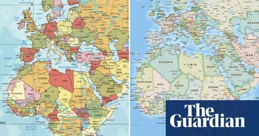
Wow, this map is very interesting and cool! But I must state the obvious: cardinal directions very much lose meaning on this one haha, not even just a little like in some other good candidates :) And yes, we don’t need precise latitudes and longitudes anymore in these days for every-day map use - hence it is even possible to talk about changing to a more “fair” projection - , but looking in a school room at this map and trying to identify with children which direction Mexico is to Cuba becomes non-trivial. This is also a form of sacrifice in this context, which of course is up to discussion.
The lines curve to the nearest pole.
So you can get a general direction of north/south.
But a “more local” map of even just a hemisphere can still be what we’re familiar with. The issue is how to get 100% of the surface of a sphere onto one flat page.
That problem disappears when zooming in. So using this projection for anything besides the whole planet doesn’t make much sense.
I mean, I’m not saying it’s easy to understand that there’s this for a global map and others for zoomed in maps, especially for an adult. But kids would pick it up quickly and understanding would build abstract thinking skills.