
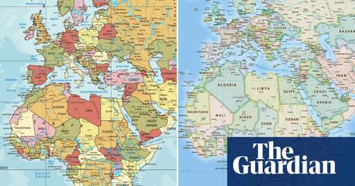
I really don’t care. But as far as i know. The landmass distortion on mercator is “corrected” by having boxes of “different sizes” across the map. Except that each box is actually respresenting the same km2
I don’t know what image on the article is about.
When looking into the eckert IV, this seems to be as accurate it gets

Which i think is quite good. It’s a good compromise between shape and landmass, by NOT projecting it on a rectangle.
Now compare this image, to the one in the article.
It looks so stupid how they’re trying to overlay them while removing the context from both.
Equal Earth looks quite good imo

Mercator’s projection of Africa isn’t miserable; what really fucks up is the Alaska/Greenland/Australia stuff that annoys me with it.
Let me guess, the US and Israel will vote against it.
Only the US voted no
You could have read it.
You are right, I misread the article. I believe the vote was set to happen, not that it had already taken place.
Doesn’t matter, still a flat earth. Checkmate globetards /s
WTF why do you have to vote ? Just go with the evidence and facts.
This may come as a shock to you. But it’s mathematically impossible to show the full surface of a sphere on a rectangle without distortion.
The mercator projection has these smaller rectangles of “different sizes” across the map. There’s a reason for that. They show the distortion of size, in favour of highlighting shapes and angles of continents
This “new” map will also have distortions. Though they will be far more difficult to show on the eckert IV projection, becase angles and shapes are now distorted, in favour of highlighting relative landmass.
So what evidence or facts is it you’re talking about? Both a projections of a sphere onto a rectangle. There will always be distortion.
yes but whose evidence and facts?
Can we also make Greenland so small that people over the age of 80 cannot see it?
Inb4 Trump claims the nation of Africa is rightfully his
The Obverse Peters Projection?
“This discussion is not a political discussion [but] a scientific discussion, because there is scientific proof so we all have to accept the reality,” he said.
Bit of a weird statement, haha. Of course it is political, the scientific reality is you cannot perfectly map a sphere to two dimensions… The political part is what we agree to sacrifice, and - in my opinion completely fairly - they want to take “relative land area” off the list of sacrifices.
I think it’s preemptively calling it out because Conservatives are absolutely going to make a map projection political
No, we’ve got some pretty good ones…
The map is made by equally dividing a spherical surface into 96 triangles, transferring it to a tetrahedron while maintaining area proportions, and unfolding it in the form of a rectangle: it is a polyhedral map projection. The map reduces the distortion of sizes and shapes of all continents and oceans, as inspired by the Dymaxion map. The projection does not have some of the major distortions of the Mercator projection, like the expansion of countries in far northern latitudes, and allows for Antarctica to be displayed accurately and in whole.[3]
https://en.wikipedia.org/wiki/AuthaGraph_projection
If you try to make one part exact, the errors add up.
If you account for the differences at a small scale, then no area is exact, but everything is pretty much correct.
The resolution proposes this one: https://en.wikipedia.org/wiki/Equal_Earth_projection
Yeah, the current standard is just so bad, there can still be a lot of improvement while maintaining the general shape were used to.
That’s actually a pretty cool map, however I really don’t like how the focal point is on an empty blue mass, making it rather impractical. It’s also rather disorienting on the southern side. I don’t think this should be adopted at all. Cool nonetheless.
Buddy…
Most of a globe is an empty blue mass…
An accurate map, is also going to have a bunch of ocean on it.
It looks weird to you, because that was your first time seeing it. You’d get used to it, and our familiarity with a shitty system should never be the reason to keep using it
In a generation people would be posting our current maps and laughing at how ignorant we are and how weird it looked.
Wow, this map is very interesting and cool! But I must state the obvious: cardinal directions very much lose meaning on this one haha, not even just a little like in some other good candidates :) And yes, we don’t need precise latitudes and longitudes anymore in these days for every-day map use - hence it is even possible to talk about changing to a more “fair” projection - , but looking in a school room at this map and trying to identify with children which direction Mexico is to Cuba becomes non-trivial. This is also a form of sacrifice in this context, which of course is up to discussion.
The lines curve to the nearest pole.
So you can get a general direction of north/south.
But a “more local” map of even just a hemisphere can still be what we’re familiar with. The issue is how to get 100% of the surface of a sphere onto one flat page.
That problem disappears when zooming in. So using this projection for anything besides the whole planet doesn’t make much sense.
I mean, I’m not saying it’s easy to understand that there’s this for a global map and others for zoomed in maps, especially for an adult. But kids would pick it up quickly and understanding would build abstract thinking skills.
Why not just make the official map a globe? We’re in the digital age ffs.
Well, if you’re going for fidelity, the planet is not a perfect sphere. Regardless, a 3D map is harder to parse and render so it makes sense to use 2D.
Eh, a 3D sphere with mapping is quite workable. Bing maps can click over an overly detailed globe and the ‘sphereness’ of it only starts to matter when you zoom out. It’s only a bit of a strain because of the texturing, and it’s not much of a strain at that.
It would not be crazy to have a more accurate interactive behavior instead of assuming that zooming out enough to see continents should still be flattened out.
Okay, you show a globe, or rather, represent a globe on a 2D surface.
Now you cannot have a single map that shows everything. And your 2D representtion is distorted anyway.
A very quick turn let’s you see the other half. Bonus, you can look at it from the perspective of a pole and get a much better view of the parts of earth that map projections just utterly mangle. Particularly helpful for understanding arctic geopolitics.
The distortion only applies if you take the screen flatness literally, and no one is going to accuse a 3d game of being hopelessly distorted by virtue of being on a flat screen.
Even if it were workable, what’s the benefit? This might sound a bit exaggerated but if you move from 2d to 3d and taking into account the number of people constantly looking at a map on their phones, car, etc, you’d be consuming way more energy and seeing absolutely no benefits.
Well, the benefit is this very discussion here, that 2D projections necessarily have distortion on zoom out…
Note that the 2D map is almost certainly already rendered into a 3D context, it’s just how modern graphics are done. Rendering textures to a curved modeled surface for isn’t significantly different than rendering them to a perfectly flat modeled surface.
Even better than Bing maps, if you go to Google maps, click ‘layers’, then click ‘more’ and check ‘globe view’, then you have a google maps that on zoom out just happens to render to sphere instead of 2D. Not the least bit more resource intensive, apples to apples with the same textures that it would have used to build the 2D map but just projected onto a sphere instead.
Do you care about directions or geography? 99 times out of 100 I think it’ll be the former.
Directions work fine, at that scale you can’t even see the difference between a globe and a flat map. It’s just zooming it out.
You have to zoom out to see about 500 miles on the screen before the curvature would even be very noticable, and at that point you aren’t caring about the navigation in detail any more.
The one travel related thing is getting a better immediate sense for why a plane or boat runs a particular course which doesn’t make sense on a typical map.
Yay, i get to post my favorite West Wing bit again!
Before watching:
“You can’t do that!”
“Why not?”
“Because it freaks me out!!”
Edit: Yep. That scene, but the last line is, “because it’s freaking me out!”
Well I don’t think they did that many specific ‘map bits’. Besides the ‘you absolutely can’t hang that map anywhere NEAR the Oval Office’ episode.
I forgot that President Bartlett smoked.
He only bummed that cigarette on Air Force One for a friend! I heard that from a reliable source.
You can’t map a sphere to a plane without distortion, it will always look off because their Gaussian curvatures aren’t the same. The best you can do is approximate it. I remember there is one type of map where they offload the distortions to the ocean so the countries look a bit better.
Map projections are a whole science.

Veto!
The equal earth map is fine ig, but a butterfly map would look sick as the un background.
I feel it’s more important we focus on changing the world maps, so that Madagascar becomes Africa’s penis.